- UNESCO World Heritage-listed city walls
-
source >
 World Heritage Center (English/French)|http://whc.unesco.org
Korean National Commission for UNESCO (translation supervision)|http://unesco.or.kr/heritage
Europe
-
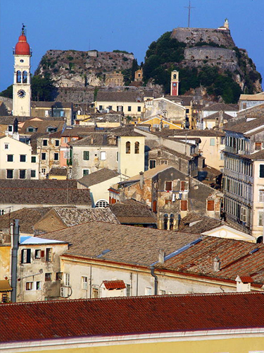 ⓒUNESCO
- Old Town of Corfu
-
country : Greece
location : Ionian Islands, Corfu Prefecture
coordinate : N39 37 26.189 , E19 55 39
Enrollment Year : 2007year
heritage area : 70ha
buffer zone : 162ha
- Standard
-
Standard(IV) :
- Summary(Ⅵ) : The Old Town of Corfu, on the Island of Corfu off the western coasts of Albania and Greece, is located in a strategic position at the entrance of the Adriatic Sea, and has its roots in the 8th century BC. The three forts of the town, designed by renowned Venetian engineers, were used for four centuries to defend the maritime trading interests of the Republic of Venice against the Ottoman Empire. In the course of time, the forts were repaired and partly rebuilt several times, more recently under British rule in the 19th century. The mainly neoclassical housing stock of the Old Town is partly from the Venetian period, partly of later construction, notably the 19th century. As a fortified Mediterranean port, Corfu’s urban and port ensemble is notable for its high level of integrity and authenticity.
-

-
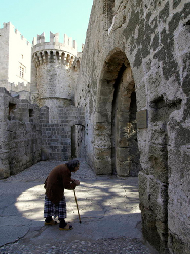 ⓒUNESCO/OUR PLACE
- Medieval City of Rhodes
-
country : Greece
location : Prefecture of Dodecanese, Region of the South Aegean
coordinate : N36 26 49.992 , E28 13 40.008
Enrollment Year : 1988year
heritage area : 66ha
buffer zone : 0ha
- Standard
-
Standard(IV) :Standard(Ⅴ) :
- Summary(Ⅵ) : The Order of St John of Jerusalem occupied Rhodes from 1309 to 1523 and set about transforming the city into a stronghold. It subsequently came under Turkish and Italian rule. With the Palace of the Grand Masters, the Great Hospital and the Street of the Knights, the Upper Town is one of the most beautiful urban ensembles of the Gothic period. In the Lower Town, Gothic architecture coexists with mosques, public baths and other buildings dating from the Ottoman period.
-

-
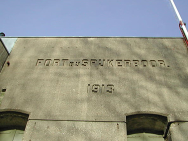 ⓒUNESCO
- Dutch Water Defence Lines
-
country : Netherlands
location : N52 33 18 E4 47 29
coordinate : N52 22 28, E4 53 35
Enrollment Year : 1996year
heritage area : 14953ha
buffer zone : 0ha
- Standard
-
Standard(Ⅱ) :
- Summary(Ⅵ) : The Dutch Water Defence Lines represents a defence system extending over 200 km along the edge of the administrative and economic heartland of Holland. It is comprised of the New Dutch Waterline and the Defence Line of Amsterdam. Built between 1815 and 1940, the system consists of a network of forts, dikes, sluices, pumping stations, canals and inundation polders, working in concert to protect the Netherlands by applying the principle of temporary flooding of the land. It has been developed thanks to the special knowledge of hydraulic engineering for defence purposes held and applied by the people of the Netherlands since the 16th century. Each of the polders along the line of fortifications has its own inundation facilities.
-

-
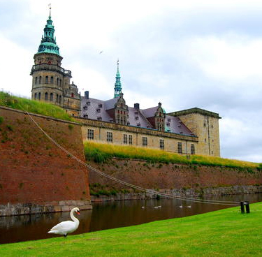 ⓒFiona Starr
- Kronborg Castle
-
country : Denmark
location :
coordinate : N56 2 20.004, E12 37 15
Enrollment Year : 2000year
heritage area : 0ha
buffer zone : 0ha
- Standard
- Summary(Ⅵ) : Located on a strategically important site commanding the Sund, the stretch of water between Denmark and Sweden, the Royal castle of Kronborg at Helsingør (Elsinore) is of immense symbolic value to the Danish people and played a key role in the history of northern Europe in the 16th-18th centuries. Work began on the construction of this outstanding Renaissance castle in 1574, and its defences were reinforced according to the canons of the period's military architecture in the late 17th century. It has remained intact to the present day. It is world-renowned as Elsinore, the setting of Shakespeare's Hamlet.
-

-
 ⓒUNESCO
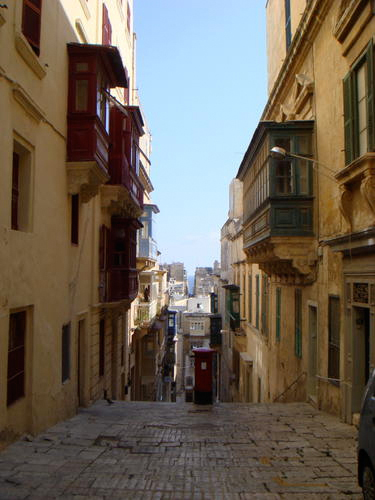
- City of Valletta
-
country : Malta
location : Island of Malta
coordinate : N35 52 2.016 , E14 30 51.984
Enrollment Year : 1980year
heritage area : 56ha
buffer zone : 0ha
- Standard
-
Standard(Ⅰ) :Standard(Ⅵ) :
- Summary(Ⅵ) : The capital of Malta is inextricably linked to the history of the military and charitable Order of St John of Jerusalem. It was ruled successively by the Phoenicians, Greeks, Carthaginians, Romans, Byzantines, Arabs and the Order of the Knights of St John. Valletta’s 320 monuments, all within an area of 55 ha, make it one of the most concentrated historic areas in the world.
-

-
 ⓒPublic Domain
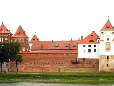
- Mir Castle Complex
-
country : Belarus
location : Grodno Province (oblast), Korelichi District
coordinate : N53 27 3.9, E26 28 21.8
Enrollment Year : 2000year
heritage area : 0ha
buffer zone : 0ha
- Standard
-
Standard(Ⅱ) :Standard(IV) :
- Summary(Ⅵ) : The construction of this castle began at the end of the 15th century, in Gothic style. It was subsequently extended and reconstructed, first in the Renaissance and then in the Baroque style. After being abandoned for nearly a century and suffering severe damage during the Napoleonic period, the castle was restored at the end of the 19th century, with the addition of a number of other elements and the landscaping of the surrounding area as a park. Its present form is graphic testimony to its often turbulent history.
-

-
Three Castles, Defensive Wall and Ramparts of the Market-Town of Bellinzona
 ⓒUNESCO
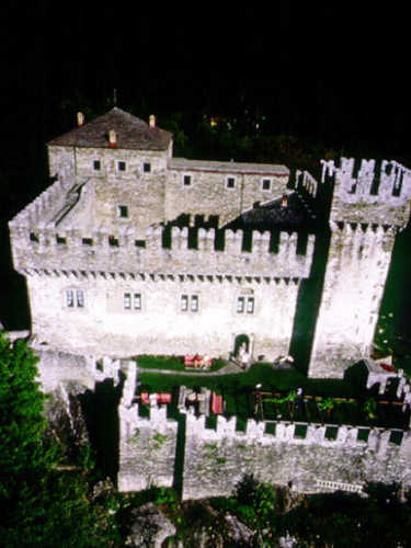
- Three Castles, Defensive Wall and Ramparts of the Market-Town of Bellinzona
-
country : Switzerland
location : Bellinzona - Canton of Ticino
coordinate : N46 11 35.304, E9 1 20.712
Enrollment Year : 2000year
heritage area : 0ha
buffer zone : 0ha
- Standard
-
Standard(IV) :
- Summary(Ⅵ) : The Bellinzona site consists of a group of fortifications grouped around the castle of Castelgrande, which stands on a rocky peak looking out over the entire Ticino valley. Running from the castle, a series of fortified walls protect the ancient town and block the passage through the valley. A second castle (Montebello) forms an integral part of the fortifications, while a third but separate castle (Sasso Corbaro) was built on an isolated rocky promontory south-east of the other fortifications.
-

-
Historic Walled Town of Cuenca
 ⓒUNESCO
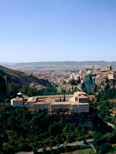
- Historic Walled Town of Cuenca
-
country : Spain
location : Province of Cuenca, Autonomous Community of Castile-La Mancha
coordinate : N40 4 35.832, W2 7 54.264
Enrollment Year : 1996year
heritage area : 0ha
buffer zone : 0ha
- Standard
-
Standard(Ⅱ) :Standard(Ⅴ) :
- Summary(Ⅵ) : Built by the Moors in a defensive position at the heart of the Caliphate of Cordoba, Cuenca is an unusually well-preserved medieval fortified city. Conquered by the Castilians in the 12th century, it became a royal town and bishopric endowed with important buildings, such as Spain's first Gothic cathedral, and the famous casas colgadas (hanging houses), suspended from sheer cliffs overlooking the Huécar river. Taking full advantage of its location, the city towers above the magnificent countryside.
-

-
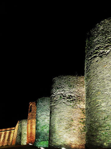 ⓒYvon Fruneau
- Roman Walls of Lugo
-
country : Spain
location : Province of Lugo, Autonomous Community of Galicia
coordinate : N43 0 39.996, W7 33 11.988
Enrollment Year : 2000year
heritage area : 0ha
buffer zone : 0ha
- Standard
-
Standard(IV) :
- Summary(Ⅵ) : The walls of Lugo were built in the later part of the 3rd century to defend the Roman town of Lucus. The entire circuit survives intact and is the finest example of late Roman fortifications in western Europe.
-

-
Bardejov Town Conservation Reserve
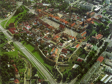 ⓒBardejov Town Conservation
- Bardejov Town Conservation Reserve
-
country : Slovakia
location : Town and District of Bardejov, Prešov Region
coordinate : N49 17 35.988, E21 16 45.012
Enrollment Year : 2000year
heritage area : 0ha
buffer zone : 0ha
- Standard
-
Standard(Ⅲ) :Standard(IV) :
- Summary(Ⅵ) : Bardejov is a small but exceptionally complete and well-preserved example of a fortified medieval town, which typifies the urbanisation in this region. Among other remarkable features, it also contains a small Jewish quarter around a fine 18th-century synagogue.
-


